Services delivered
What we built and ran for geosoft.sk
We engaged geosoft.sk across the services above, taking ownership of execution and reporting on measurable outcomes. To see numbers from this engagement under NDA, book a 30-min call.
Snapshot
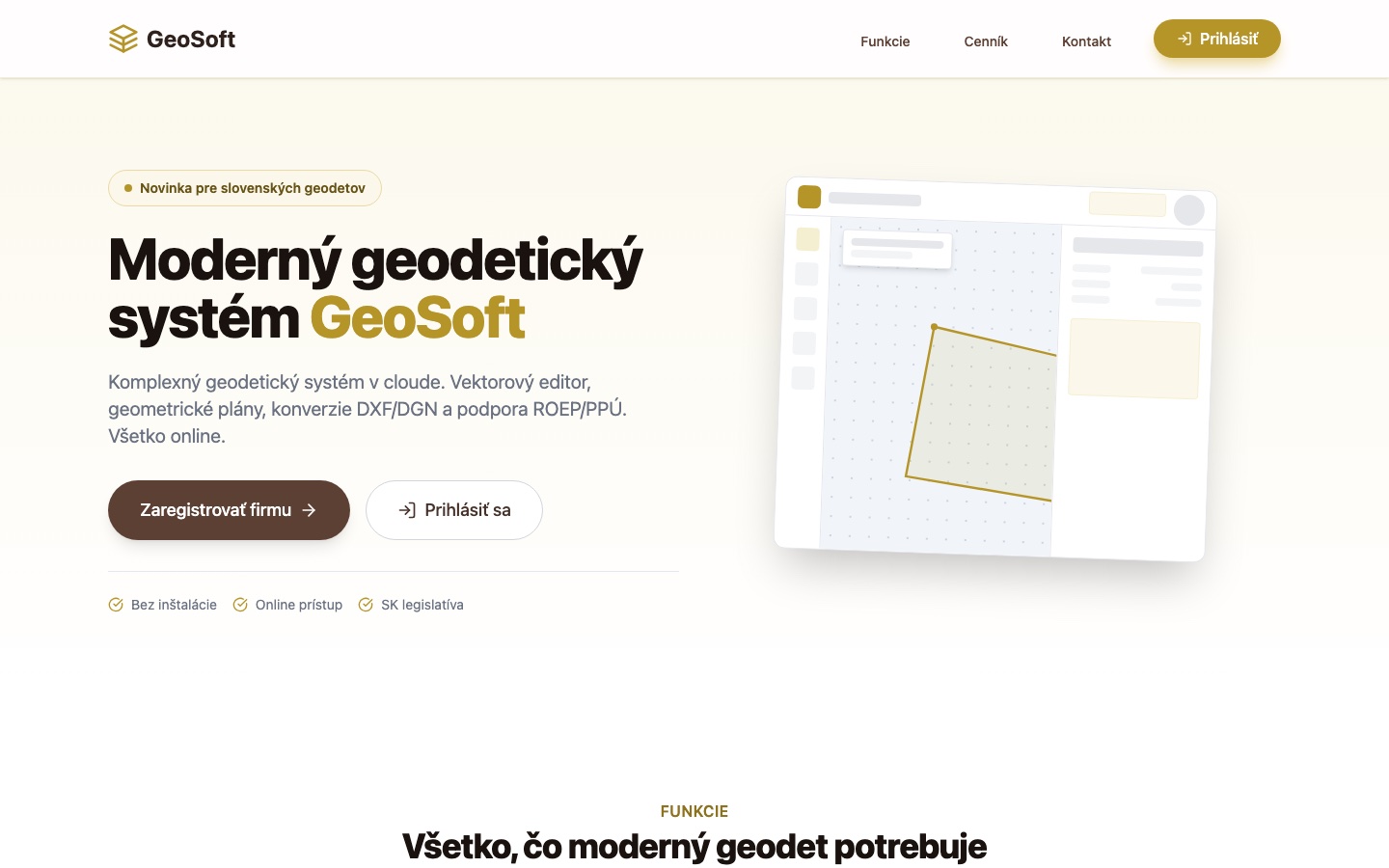
Client: GeoSoft – a new Slovak SaaS for land surveyors (geodeti) in Slovakia and Czechia.
Engagement: Take a professional workflow that has lived in Windows desktop software since the 1990s and move it – whole – into the browser: CAD drawing, geodetic computation, cadastral outputs and data conversions, delivered as a subscription instead of per-PC licences.
What we shipped: A multi-tenant web application with a React CAD editor up front and a GeoDjango + PostGIS computation engine behind it. Every surveying firm gets an isolated workspace on its own subdomain; registration takes under a minute, with no card and no installation.
The product at a glance
| Drawing tools | 11 – point, line, polygon, circle, arc, rectangle, spline, text, dimension, symbol, measure |
| Geodetic methods | polar, orthogonal, intersections, free station (least squares), Helmert transformation, 3D rajón, levelling network adjustment |
| Coordinate systems | S-JTSK, WGS84, UTM |
| Data formats | DXF, SHP, VGI in · DXF, SHP, VFK, PDF out |
| Tenancy | isolated workspace per firm, on its own subdomain |
What we actually built
1. A CAD editor that lives in a tab
An SVG-based canvas with pan/zoom, layer management, undo/redo and eleven drawing tools. Around it, the details that make CAD usable for real work: a snap engine (endpoints, midpoints, intersections, perpendicular feet), vertex editing with drag handles, and a command line modelled on the legacy desktop software surveyors already know – twenty years of keyboard muscle memory keeps working, including UNDO/REDO.
2. A real computation core, not a drawing toy
Geodetic software stands or falls on the maths. The backend engine covers the polar and orthogonal methods, intersections, free-station setup solved as a full least-squares adjustment, Helmert transformation, 3D polar survey (rajón) and 1D levelling network adjustment – with coordinates handled natively in S-JTSK, WGS84 and UTM, and areas reported in m², ares and hectares.
3. Cadastre-native outputs
The deliverables a surveying office actually invoices: geometric plans (GPL) including VFK export for the cadastre, parcel management with Czech/Slovak parcel-number handling (1234/5), land-consolidation workflows (ROEP/PPÚ) and print layouts exported to PDF.
4. Conversions as daily bread
A surveyor’s day is format juggling, so import/export is a first-class feature, not an afterthought: DXF, SHP and VGI in; DXF, SHP and VFK out. The conversion pipeline preserves layers and attributes instead of flattening the drawing.
5. Multi-tenant SaaS underneath
One codebase, many firms: multi-tenant architecture on PostGIS gives each company an isolated workspace with its own data and its own subdomain. Full functionality on every plan, unlimited projects, no long-term contract – and priority support that includes help migrating from the legacy desktop tools.
What we’re holding back
The symbol-library internals, the VFK pipeline roadmap, the real-time collaboration plans and what the e2e test suite looks like for a CAD canvas. Happy to walk through it on a call.
Stack
React 19 · TypeScript · Vite · SVG canvas · Django 5 · GeoDjango · PostGIS · django-tenants · Docker · Playwright.
Still running your industry on a 2005 desktop app?
If your team’s core workflow lives in an aging Windows program – CAD, estimating, planning, ERP – this is exactly the kind of web application we build. Tell us about it and we’ll come back with a scope, a timeline and a number.
More work
Related case studies
Other clients using Custom software development + Website creation.

Want a result like geosoft.sk?
Tell us about your business – we'll come back with a plan, a timeline and a number you can budget against.